.jpg?ixlib=gatsbyFP&auto=compress%2Cformat&fit=max&q=75&w=375)
Artificial islands have long captured the imagination of humanity, blending elements of engineering prowess and architectural innovation. These man-made marvels have evolved over the years, from their historical origins to their present-day manifestations, offering a unique perspective on the interaction between human ingenuity and the natural environment. In this essay, we delve into the intriguing world of artificial islands, focusing on the evolution of these structures and their genuine impact on the constructed environment. Through the lens of 3D visualization and architectural visualization, we will explore how these technologies have played a pivotal role in shaping the design, construction, and assessment of artificial islands.
Credit: BBC
Historical Origins of Artificial Islands
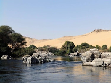
To comprehend the evolution of artificial islands, we must first explore their historical origins. The concept of creating islands has been documented in various ancient civilizations, including the Egyptians and the Chinese. These early efforts were often driven by practical needs such as flood control, agriculture, and transportation.
In Egypt, the ancient Egyptians built artificial islands called "nilometers" along the Nile River to measure water levels, ensuring proper irrigation for their crops. Similarly, the Chinese developed a sophisticated system of building artificial islands for agriculture, using fertile silt from riverbanks to create arable land.
The development of these early artificial islands laid the groundwork for more ambitious endeavors in later centuries. However, it wasn't until the modern era that artificial islands truly began to flourish.
Credit: BBC
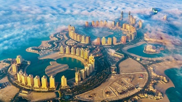
The Rise of Modern Artificial Islands
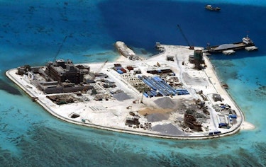
The 20th century witnessed a surge in artificial island construction, driven by a combination of technological advancements and urban expansion. The need for additional land for various purposes, such as residential, commercial, and industrial, fueled the development of artificial islands in different parts of the world.
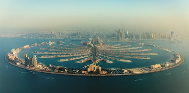
One of the most iconic examples of modern artificial islands is the Palm Jumeirah in Dubai, UAE. Constructed in the early 2000s, this palm-shaped island is a testament to human engineering prowess. Advanced 3D visualization and architectural visualization technologies played a crucial role in planning and executing this massive project. These tools allowed engineers and architects to model the island's intricate design, assess environmental impacts, and optimize the use of available space.
Credit: the Palm Jumeirah
3D Visualization in Artificial Island Development
The advent of 3D visualization has revolutionized the way artificial islands are conceived and designed. This technology allows architects, engineers, and urban planners to create highly detailed and realistic digital models of proposed islands. These models can simulate the impact of various factors, such as sea level rise, storm surges, and ecological consequences.
One of the key benefits of 3D visualization is its ability to facilitate interdisciplinary collaboration. Professionals from different fields can work together in a virtual environment, making real-time adjustments and improvements to the island's design. This level of collaboration enhances the overall quality of the project and minimizes potential issues during construction.
Moreover, 3D visualization enables stakeholders and the public to better understand the proposed artificial island's design and its impact on the environment. Transparent communication through visual representations fosters informed decision-making and community engagement.
Credit: Amazing Architecture
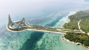
Architectural Visualization and Design Innovation
Architectural visualization complements 3D visualization by focusing on the aesthetic and functional aspects of artificial islands. It allows architects to explore different design concepts and experiment with materials, colors, and spatial arrangements in a virtual environment.
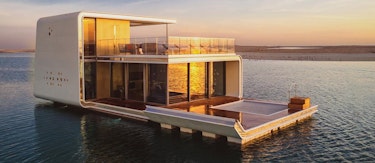
In the case of artificial islands, architectural visualization can play a pivotal role in creating visually striking and environmentally sustainable structures. For example, the Floating Seahorse Villas in Dubai blend luxury living with marine conservation efforts. Architectural visualization tools helped refine the design of these floating villas, ensuring they are both aesthetically pleasing and ecologically responsible.
Additionally, architectural visualization can assist in the integration of green technologies into artificial island projects. Concepts such as vertical gardens, solar panels, and rainwater harvesting systems can be visualized and optimized to maximize their efficiency and sustainability.
Credit: Forbes
Environmental Impact Assessment
Artificial islands often have significant ecological consequences, impacting marine life, water quality, and coastal ecosystems. The use of 3D visualization and architectural visualization in environmental impact assessments is critical to mitigating these effects.
By creating detailed models of the artificial island and its surroundings, experts can simulate how the structure will interact with the natural environment. This includes assessing potential changes in water flow patterns, sedimentation rates, and the behavior of marine species.
Moreover, these technologies allow for the visualization of mitigation measures. For instance, the creation of artificial reefs or the restoration of coastal habitats can be modeled and analyzed to ensure they are effective in offsetting environmental impacts.
Credit: ArchDaily
Sustainable Design and Resilience
In an era marked by climate change and rising sea levels, the design and construction of artificial islands must prioritize sustainability and resilience. 3D visualization and architectural visualization are invaluable tools in achieving these goals.
Sustainable design principles, such as low-impact construction materials and energy-efficient infrastructure, can be incorporated into the virtual models of artificial islands. This not only reduces the ecological footprint of these projects but also ensures their long-term viability in the face of environmental challenges.
Resilience planning involves simulating extreme weather events and sea level rise scenarios to evaluate the island's ability to withstand such challenges. 3D visualization allows engineers to identify vulnerabilities and make necessary adaptations, while architectural visualization ensures that these adaptations do not compromise the island's aesthetics or functionality.
Credit: ArchDaily
The evolution of artificial islands from ancient agricultural endeavors to modern urban developments is a testament to human innovation and adaptability. Throughout this journey, 3D visualization and architectural visualization have emerged as indispensable tools in shaping the design, construction, and assessment of these complex structures. These technologies have not only facilitated interdisciplinary collaboration but have also empowered stakeholders and the public to engage in informed decision-making. They have played a vital role in creating environmentally sustainable and visually captivating artificial islands that meet the needs of contemporary society while respecting the natural world.
As artificial island projects continue to evolve and expand, 3D visualization and architectural visualization will remain at the forefront of innovation, ensuring that these constructed environments leave a positive and lasting impact on both the human experience and the broader ecosystem.